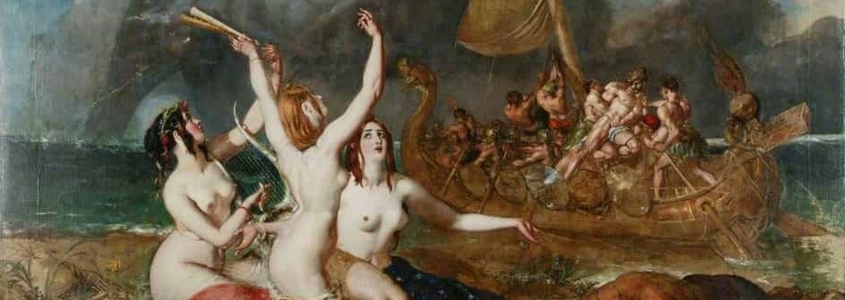
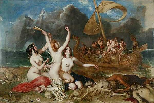


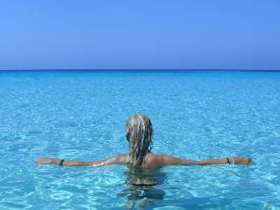
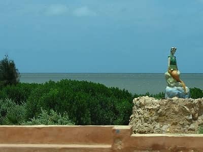
The visitor who approaches the island of Djerba is struck by its resemblance to Polynesia. ust arrived, he is invaded by a feeling of sweetness and serenity. Do not forget, during his stopover in Djerba, the island of Lotophages, Ulysses almost gave up his wandering.
On February 17th 2012, the Tunisian government proposes Djerba for a future classification on the UNESCO world heritage list.
Support Djerba's candidacy for inscription on the UNESCO World Heritage List.
Content subject to license CC-BY-SA. Source : Article Djerba from Wikipédia (authors)
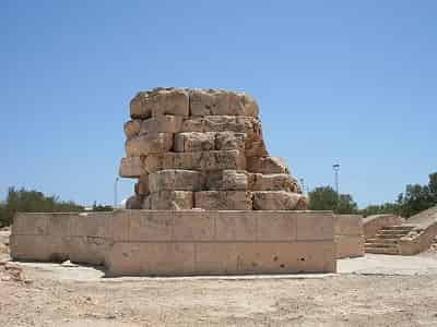
Djerba was well known during Antiquity, since the hero of Homer, Ulysses, stopped there. It was Carthaginian, then Roman. Two Roman emperors were born there. The island keeps vestiges from the Roman era : Meninx, near El Kantara, and the 6 km Roman road, which still connects the island to the mainland.
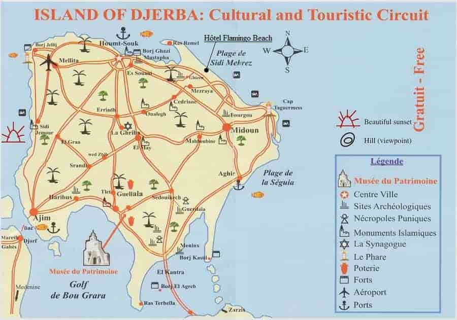
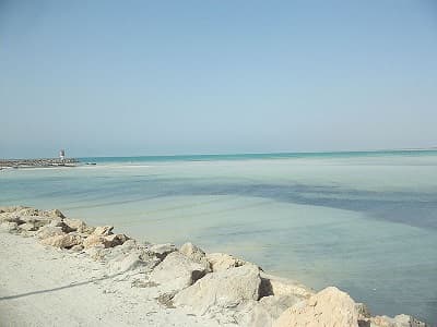
With 25 km long and 22 km wide, Djerba has an area of 514 km² and has 125 km of coastline, its 1/10 of the Tunisian coast. Flat earth and very low altitude, it has no salient relief. The climate, under the moderating influence of the sea, is very mild.
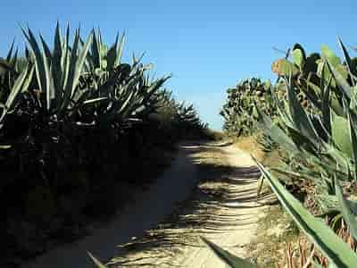
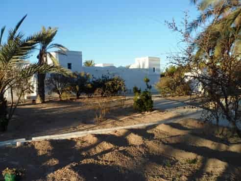
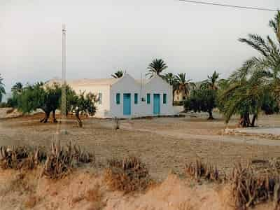
Except for the capital, Houmt Souk, which is a small town which has kept its charm of yesteryear, agglomerations are only small villages : Midoun, Mahboubine, Guellala, Ajim… Habitat is dispersed : in the middle of the Menzel, a small farm bounded by a tabia, a levee surmounted by a cactus hedge, rises the house, called houch.
Also human concentrations are rare. The few agglomerations take, therefore, a particular relief and acquire a clearly marked personality.
Inhabitants:42 992 in 2014. Market days: Monday and Thursday. We find there:
Djerba traditional heritage museum.
Citizen59[Public domain]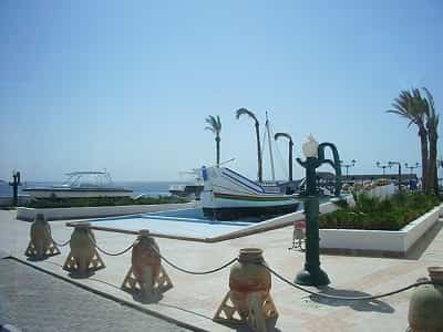
Inhabitants:15 114 in 2014. We find there:
Vidéo YouTube 6.39min: Arrival in Djerba by ferry.
Jaume Ollé [CC BY]
Inhabitants:9 180 in 2014. We find there:
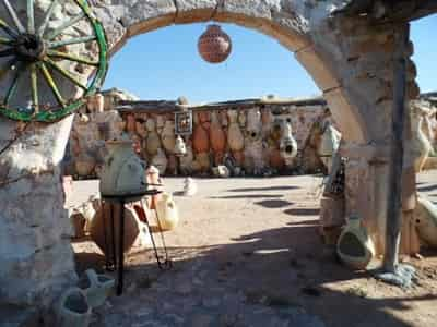
Vidéo YouTube 7.30min: Pottery at Guellela Djerba.
Bsghaier [CC BY-SA]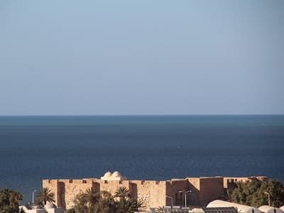
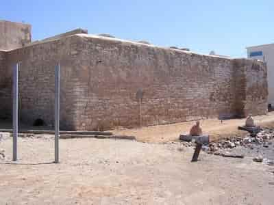
Borj El Kebir is built around 1392 on the ruins of the ancient Roman city of Girba (current Houmt Souk), the remains of which are re-used in the construction of the structure, following the expulsion of Alphonse's Vth soldiers of Aragon and according to the orders of the Hafsid sultan of Tunis to house his garrison. Around 1450, it underwent extensions. There is nearby
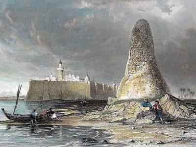
In 1560 Dragut besieged the Iberian army, assisted by the natives and a fleet from Istanbul. The siege ended in a great defeat for the Spanish army, thousands of them lost their lives there. Carried away by its great triumph Dragut even built a conical tower 40 m at the base and ten meters high. It was crammed full of skulls and other macabre bones taken from thousands of soldiers. This skull tower survived until 1848, date on which it was razed and replaced by the obelisk symbolizing it. There is nearby:
Drawn by T. Allom, engraved by E. Benjamin [Public domain]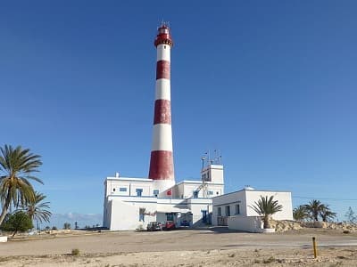
This lighthouse, one of the symbols of Djerba, was built at the end of the XIXth century under the order of the bey. Built on a 20 meters hill in the northeast of the island, this 75-meter lighthouse is characterized by its colors (white and red) of the Tunisian flag. With a range exceeding 50 kilometers, this « phnar de Taguermess » as the Djerbians call it, is the first bright sign that sailors from the east and heading for the Maghreb coasts observed. There is nearby:
Citizen59 [CC BY]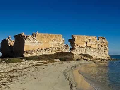
Built in the XIIIth century by Roger Lorie, Admiral of the north of Sicily. This fort is located in the southern part of the island at the end of the peninsula Bine El Ouediane.
El Golli Mohamed [CC BY-SA]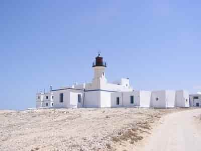
It is the first lighthouse on the island, 12km from the town of Mellita, it was built in the XVIth century on the traces of an old Spanish fort « the Valgarnera tower ». The lighting system of this lighthouse was based on olive oil. This lighthouse was installed to facilitate maritime navigation as in all the islands of the Mediterranean, to help fishermen at night, when the sky is overcast, to find their way and to monitor the island against enemy invasions. At the east of this lighthouse, a fort was built by Ali Bacha Bey in 1745 and completed by Hamouda Bey in 1795.
The Borj Ajim is located in the southwestern tip of the island. On the road connecting the port to the city of Ajim. On the right side of this road we can notice a fort whose walls have a square shape and do not exceed 6 meters high. This fort is also called «Borj el mersa» (fort of the port). This fort was used to defend and protect both the main entrance to the island through the Ajim Canal.
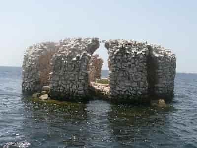
Located in the southern tip of the island between Ras Tarbila and El Kantara (The romain road). With a circular shape, it is surrounded by the sea. Built by Dragut in the XVIth century. It is known as the scorpion fort following a legend which tells that a prince who had lost all his children because of scorpion stings, led his last son to this isolated fort. But one day the child received a bunch of grapes in which a scorpion was hiding, which caused the death of this child. Hence the name of this fort in Borj El Agreb (borj of scorpio).
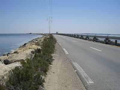
The island is connected on the south side to the mainland by a bridge 7 kilometers long and about 10 meters wide. The latter dates back to Roman Antiquity, even to the Punic era. The bridge is then submerged by the sea and then cut around 1551, during the conflicts between Dragut and the Spanish, before being finally rebuilt during the second world war. There is nearby:
A l'est: Meninx archaeological site.
A l'est: Borj El Kastil Djerba.
A l'ouest: Borj El Agreb Djerba.
Big [CC BY-SA]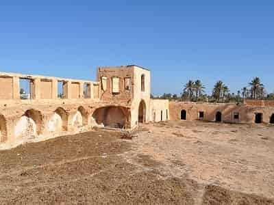
Built in the XVIIIth century by Caid Hamida Ben Ayed, a wealthy politician and financial at the time of the Husseinite Beys. Ben Ayed Castle is located in Sedghiane, once the capital of the island of Djerba. Unfortunately the castle is on the way to becoming a ruin.
Ness cheikhali [CC BY-SA]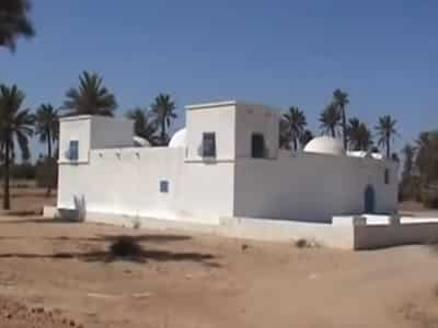
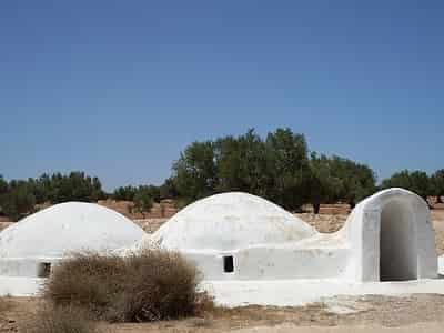
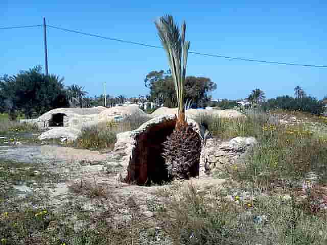
A Menzel (arabic:« residence »), is a typical type of accommodation in Djerba. It consists of an agricultural plot planted with palm trees, olive trees, fruit trees, sorghum, cereals or vegetable crops. The Menzel is equipped with one or more wells or tanks intended for the irrigation of fields.
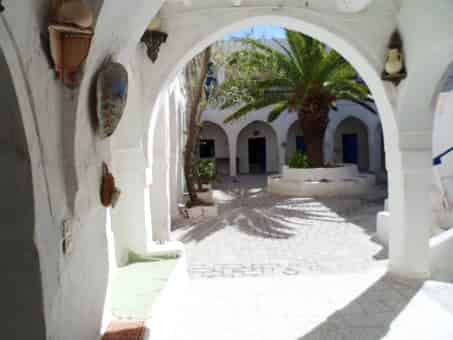
One or more housing units, the houch, are organized around a central patio and include rooms covered with flat or vaulted domed roofs. It can include an attic, a stable, a threshing floor (errayah), a weaving workshop and an oil mill.
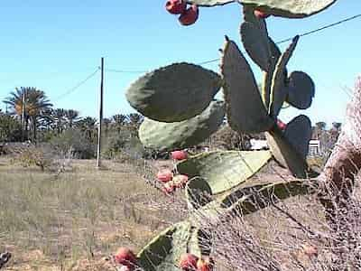
The Menzel is also protected by hedges (tabia) made up of agave, aloe or prickly pear plantations. A model is exhibited at:
Djerba traditional heritage museum.
Les HOUCHS de DJERBA: Video YouTube 11.39min.
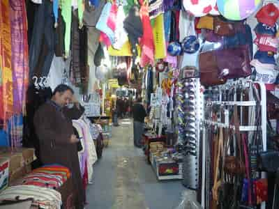
The Italian etymology of the term « fondacco » denotes a kind of construction characteristic of Mediterranean and Middle Eastern cities. It is synonymous with the Egyptian word « oukala » signifying an establishment intended to receive traders accompanied by their goods and their cattle. Those of Houmt Souk pass for urban fondouks who started to swarm around the Mediterranean towards the end of the XVIth century. Christian, Jewish and Muslim traders gather there to stock up on salt, fruit, oil, pottery, and especially woollens. The warehouses and the upstairs bedrooms were mainly shaded by arcaded galleries, embracing a spacious patio on all sides. There is an underground tank (for receiving rainwater) and a well (for laundry and toilets).In Djerba there were formerly 25 fondouks.
Bsghaier [CC BY-SA]
To see also on our website
Do not hesitate to join us